#NIFC #wildfires #firewx
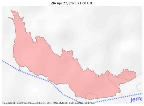
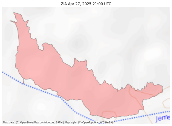
NIFC New Or Updated Wildfire Perimeter
Incident Name: ZIA
Acres: 45.5 acres
Updated: Apr 27, 2025 21:00 UTC
Source: IRWIN
#ZIAFire #NMwx
Recent searches
Search options
#nmwx
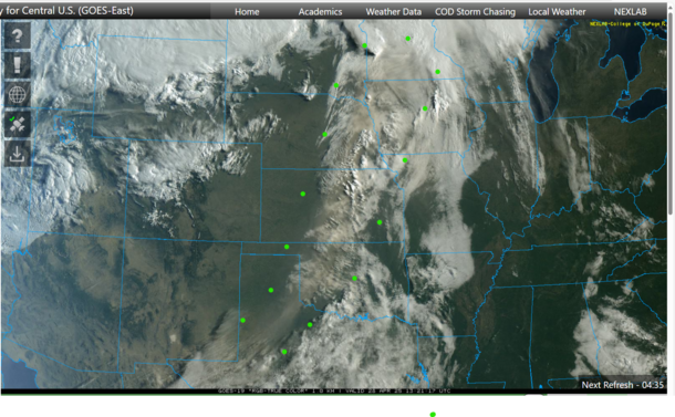
Where did yesterday's dust storm end up?
This weather satellite image at sunrise today shows a brownish plume that extends up to parts of Nebraska, Iowa, etc. (I surrounded the dusty plume with green dots.)
This is a follow up to:
https://universeodon.com/@KrajciTom/114413002689880165
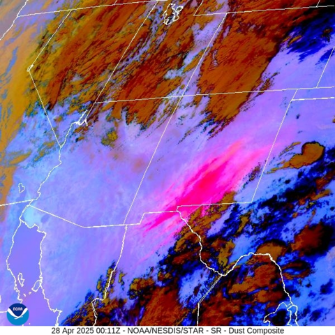
Yet another dust storm over the southeast half of New Mexico, far west Texas, the Texas panhandle, Oklahoma panhandle, extending into Colorado and Kansas.
The dust is coming from prehistoric lake beds in northern Chihuahua, Mexico:
https://en.wikipedia.org/wiki/Lake_Palomas
"Presently its basin is a major source of airborne dust in the region."
With the severe drought conditions in this region, it takes far weaker winds to create these dust storms compared to previous decades. Visibility at my house is less than 1/2 mile.
Note that the dust is tan, but that the gypsum dust from White Sands is paler. A fire is burning in northeast Sonora, Mexico...the smoke plume is bluish. A fire develops in central New Mexico (Rio Grande valley, town of Socorro) at the end of the animation loop. https://app.watchduty.org/i/47153
Wow, major dust storm visible on satellite in southern NM today. Stay off the roads, folks! 4/27/25 1823MT #NMwx #duststorm #dust
Wow, serious dust storm in New Mexico (again) 4/27/25 1822MT #duststorm #NMwx
#NIFC #wildfires #firewx
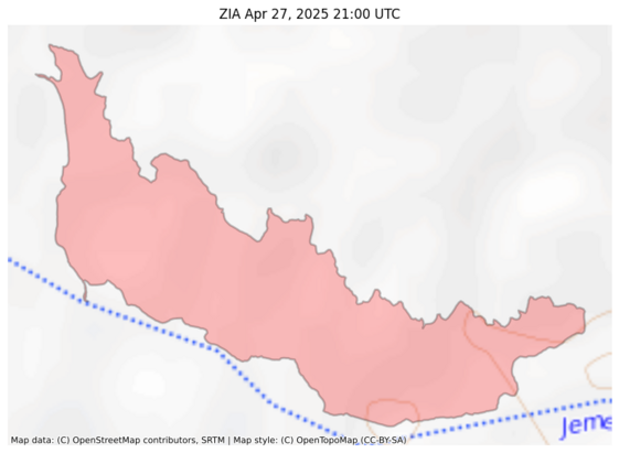
NIFC New Or Updated Wildfire Perimeter
Incident Name: ZIA
Acres: 45.5 acres
Updated: Apr 27, 2025 21:00 UTC
Source: IRWIN
#ZIAFire #NMwx
#NIFC #wildfires #firewx
NIFC New Or Updated Wildfire Perimeter
Incident Name: ZIA
Acres: 45.5 acres
Updated: Apr 27, 2025 21:00 UTC
Source: IRWIN
#ZIAFire #NMwx
This. #Wind. Is. Insane. Holy crap. I'd hate to be flying in or out of the Sunport today.
#ABQ #ABQwx #HighWindWarning #NM #NMwx #Albuquerque #NewMexico
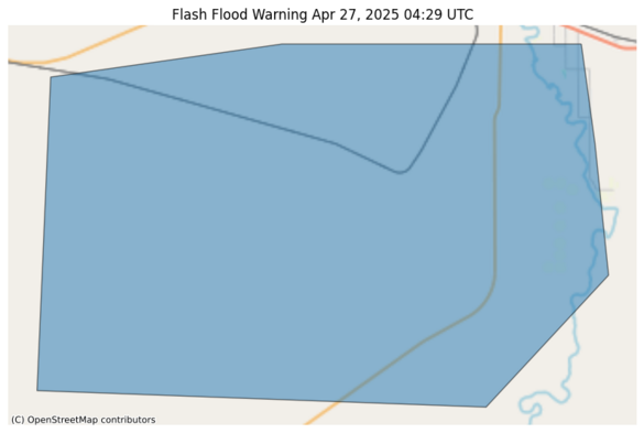
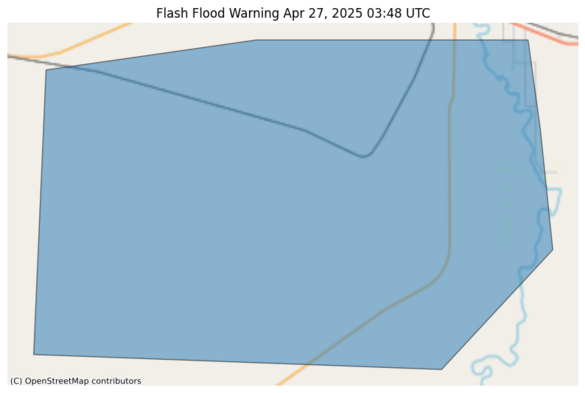
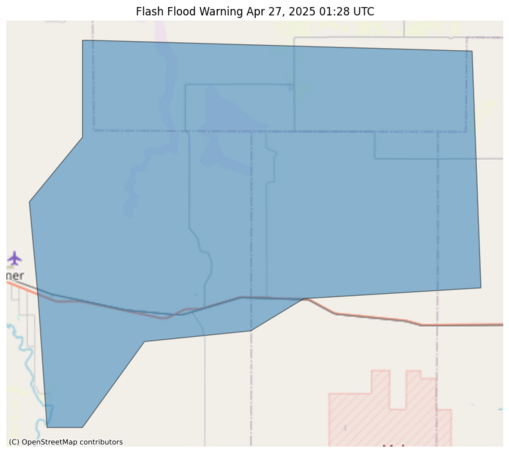
#NWS #flood #nwsflashflood #FlashFloodWarning Flash Flood Warning for Curry, NM; De Baca, NM; Quay, NM; Roosevelt, NM #NMwx https://alerts-v2.weather.gov/search?id=urn:oid:2.49.0.1.840.0.6b3c24818e086626213a33c0636229dc13e9de14.001.1
It was a dynamic weather day in New Mexico.
This weather satellite loop shows us a variety of activity:
- overall west-to-east flow of dry air in the western half of New Mexico. This dry air is not very dusty, at least not initially.
- moist air over the eastern half, which tends to be hazier. This haziness is seen best near the end of the loop when the sun angle gets low.
- strong thunderstorms developing along the dry line
- outflows and gust fronts from the storms raising dust and pushing it east against the flow of the dry air
- strong breezes in northeast Sonora, Mexico boost fire activity. The bluish smoke plume becomes visible near the end of the loop. The strong breezes also pick up dust at the end of the loop...colored tan/brown
- the moist air can't push further west because the terrain gets higher.
This is a follow up to an earlier post/toot about the Dry Line weather system:
https://universeodon.com/@KrajciTom/114406001338553756
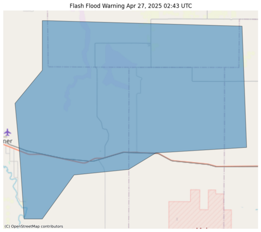
#NWS #flood #nwsflashflood #FlashFloodWarning Flash Flood Warning for De Baca, NM; Guadalupe, NM #NMwx https://alerts-v2.weather.gov/search?id=urn:oid:2.49.0.1.840.0.5743952a7da338a4979a59ba02f46ee91d698de2.001.1
#NWS #flood #nwsflashflood #FlashFloodWarning Flash Flood Warning for Curry, NM; De Baca, NM; Quay, NM; Roosevelt, NM #NMwx https://alerts-v2.weather.gov/search?id=urn:oid:2.49.0.1.840.0.5ae2bf1b7f68a91943b1fbbfde22dc273e1655f3.001.1

