sfba.social is one of the many independent Mastodon servers you can use to participate in the fediverse.
A Mastodon instance for the San Francisco Bay Area. Come on in and join us!

Server stats:

2.3K
active users

#osm

42 posts38 participants5 posts today

Have you ever needed street widths on #openstreetmap but found that the width data on #osm is very much incomplete and if present, often in non standardized notation?
I ran into this problem recently and published a #python package that deals with this problem: osm guesstimator.

github.com/PizzaTreeIsland/osm

Guesstimate properties like street width in incomplete osm data - PizzaTreeIsland/osm_guesstimator
GitHubGitHub - PizzaTreeIsland/osm_guesstimator: Guesstimate properties like street width in incomplete osm dataGuesstimate properties like street width in incomplete osm data - PizzaTreeIsland/osm_guesstimator

👉 weeklyosm.eu/archives/17824 👈
Issue 769 of #weeklyOSM is out. 🌏
涵蓋 #開放街圖 #osm 世界大小事的新一期 weeklyOSM 已經發佈 🚀
Lisez les dernières nouvelles de l'univers #openstreetmap 🗺️
Viele Neuigkeiten aus der #osm Welt 📰
新一期的OSM周刊已经发布 🌏
Se ha publicado un nuevo número del semanarioOSM 🌐
最新の週刊OSMが発行されました。⛩️
주간OSM 최신호가 나왔습니다 💬
Тижневик OSM тепер доступний Українською 📲
@openstreetmap

Google Maps has decided I live in a town about 16km from my house. I did nothing to change this, and it's been defaulting to my actual house for the four years I've lived here.

Apple Maps on my phone doesn't list as many local businesses.

Does OpenStreetMap know about local businesses/restaurants? Is there a good "I just need to search a map" front-end?

If there are any OpenStreetMap contributors reading, I have an important correction that needs to be made regarding Spokane, Washington:

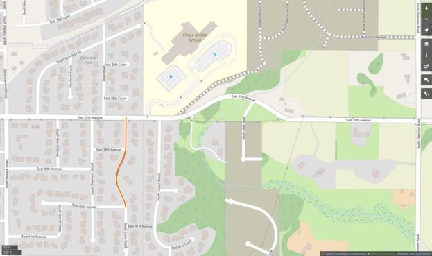
I used to live on the South Hill, and could walk to Moran Prairie Elementary School within 10 minutes. It was located at the base of the hill (the street I used to live on is highlighted in orange) However, on OpenStreetMap, it is showing Chase Middle School, which is much further away. I don't know how to edit OpenStreetMap, but there is an important correction that needs to be made here.

I have noted this error to be visible for over 2 months without any attempts to fix it.

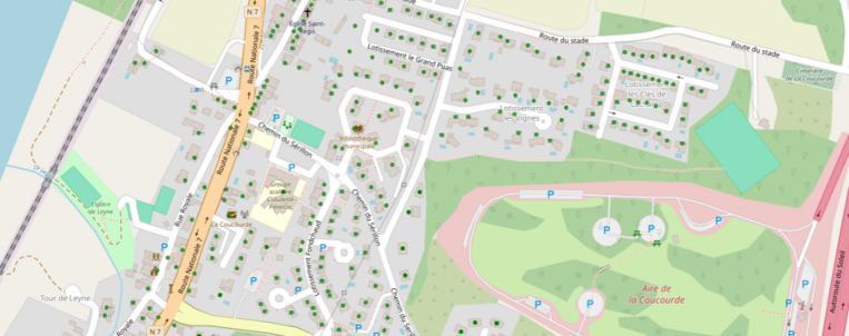
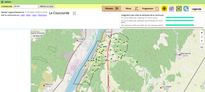
Le projet BANO (Base Adresses Nationale Ouverte sur OpenStreetMap France avance doucement mais sûrement en Drôme (26). Dernièrement, j'ai réalisé l'adressage des communes suivantes :

- La Coucourde
- Les Tourrettes
- Condillac
- Grâne
- Ambonil
- Cliousclat
- Bellecombe-Tarendol
- Valouse
- Teyssières
- Rouchefourchat

D'autres communes sont en cours :
- Mirmande
- Vesc
- Loriol-sur-Drôme

Does Open Street Map intentionally include fake data? I've added a note on something which demonstrably doesn't exist but wonder why / how it got there in the first place.